Temperance Map
––:»Temperance Map«
An early 19th century allegoric map of temperance
In Collection
- Title
- Temperance Map
- Author/Creator
- Wiltberger, John Christian
- Date Created
- 1938
- Abstract
- An early 19th century allegoric map of temperance
- Description
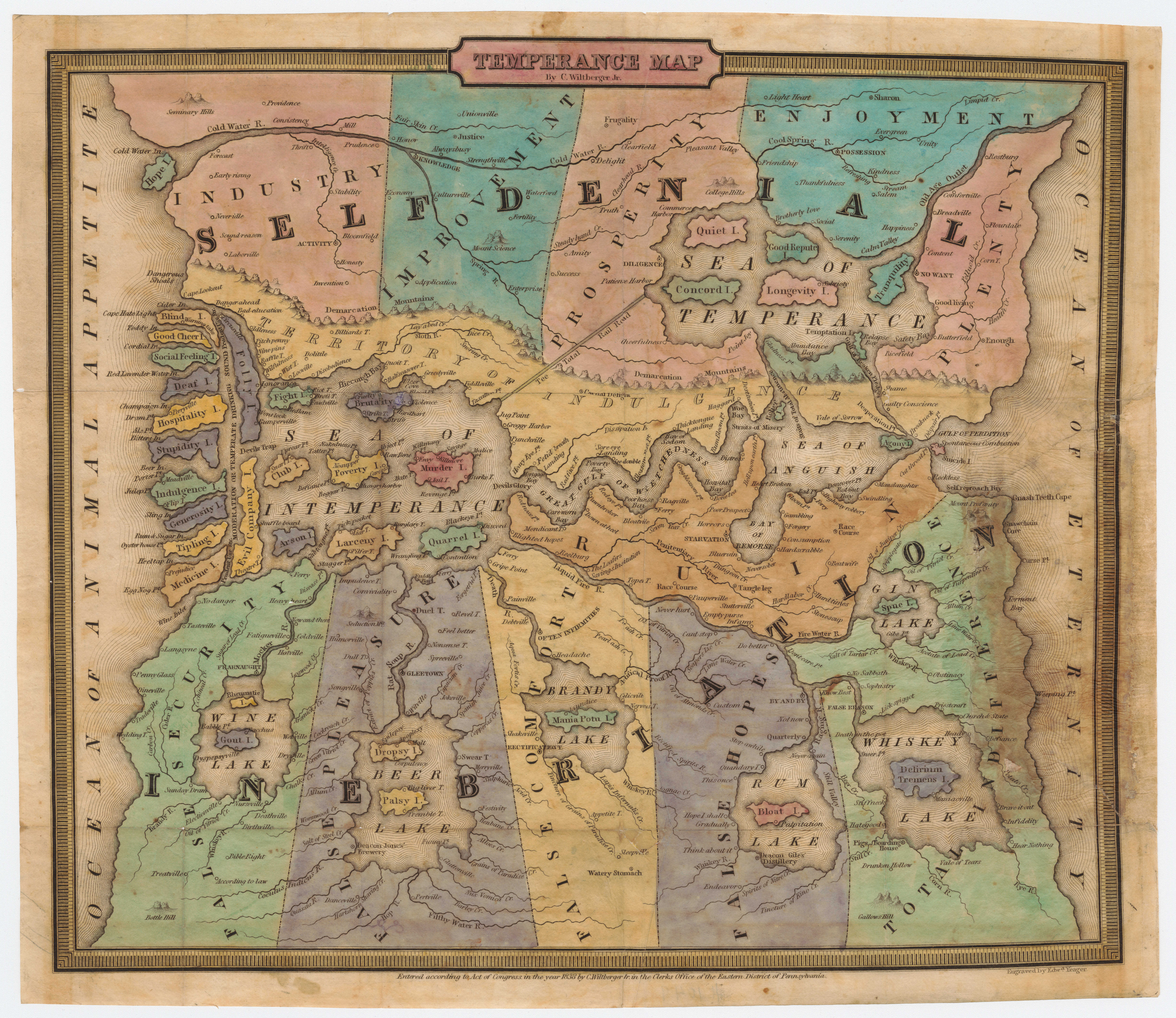
- This map by Reverend John Christian Wiltberger is one of the earliest cartographic representations of alcohol. Printed in 1838, this allegoric map does not depict real places but the two imaginary continents of Inebriation and Selfdenial. As Susan Schulten puts it, the map “invite[s] readers to navigate sin and temptation” (Schulten 2018, S. 126) and thereby helps them to find their way to righteousness. The map offers abundant details and teaches restrain and abstinence: While in the west we encounter the islands of Good Cheer, Hospitality and Medicine, only the narrow sound of Temperate Drinking keeps us from the Devils Trap that quickly leads to the Sea of Intemperance. Happiness and a good life can only be archived through staying in the lands of Selfdenial, were the towns of Fertility and Enterprise can be found at the foot of Mount Science in the State of Improvement. South of the Sea of Intemperance and the Great Gulf of Wretchedness are the lands of False Hopes, the Beer Lake and the Bay of Remorse.
- Subject
- Alcohol
- Spatial Coverage (Place)
- imaginary
- Type
- Book
- Format/size
- 31 x 36cm
- Source
- Persuasive Maps: PJ Mode Collection
- Language
- English
Narcotic Archive Item-ID
Permalink
https://narcotic-archive.org/s/archive/item/119
In Collection
Media_ID#120 (Original: 6956×6021px, 8.7 MB)