Historical Cartographies of Alcohol
Since their invention in the 19th century, thematic maps have been widely used to map what bourgeois authors perceived as social ills and moral lapses. The rapidly growing cities in particular seemed to these authors to be places associated with problematic behaviour and problematic people. Alcohol was high on the list of these urban vices.
This collection brings together historical maps about alcohol in order to contribute to a critical cartography of the consumption of alcohol in urban public space.
While most maps originated in the context of the various temperance movements, some are also counter maps and maps that tried to challenge these depictions.
Curated by Boris Michel
- Title
- Historical Cartographies of Alcohol
- Abstract
- Since their invention in the 19th century, thematic maps have been widely used to map what bourgeois authors perceived as social ills and moral lapses.
- Description
- Since their invention in the 19th century, thematic maps have been widely used to map what bourgeois authors perceived as social ills and moral lapses. The rapidly growing cities in particular seemed to these authors to be places associated with problematic behaviour and problematic people. Alcohol was high on the list of these urban vices.
This collection brings together historical maps about alcohol in order to contribute to a critical cartography of the consumption of alcohol in urban public space.
While most maps originated in the context of the various temperance movements, some are also counter maps and maps that tried to challenge these depictions. - Creator
- Boris Michel
-
Chicago, USA · in English
![If Christ came to Chicago! A plea for the union of all who love in the service of all who suffer]() If Christ came to Chicago! A plea for the union of all who love in the service of all who suffer-- »If Christ came to Chicago! A plea for the union of all who love in the service of all who suffer«
If Christ came to Chicago! A plea for the union of all who love in the service of all who suffer-- »If Christ came to Chicago! A plea for the union of all who love in the service of all who suffer«
Map from William Thomas Stead’s “If Christ came to Chicago!, showing brothels, saloons, pawn brokers and lodging houses in Chicago's 19th precinct.
(Type: map)
Subjects: alcohol,
-
Greater London, United Kingdom · in English
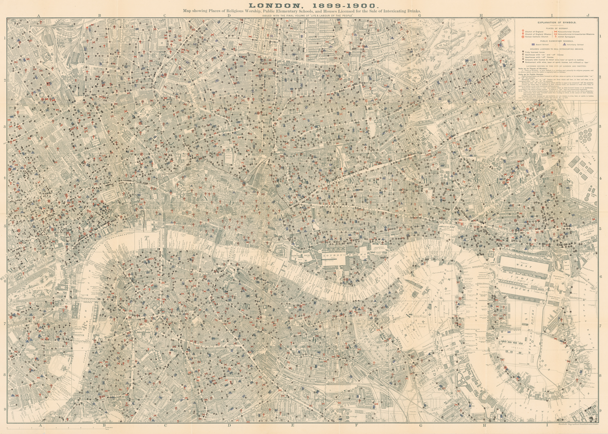
![Map of London Pubs, Churches & Schools]() Map of London Pubs, Churches & Schools-- »Map of London Pubs, Churches & Schools«
Map of London Pubs, Churches & Schools-- »Map of London Pubs, Churches & Schools«
Map showing Places of Religious Worship, Public Elementary Schools, and Houses Licensed for the Sale of Intoxicating Drinks.
(Type: map)
Subjects: Alcohol,
-
England, United Kingdom · in English
![Distribution of Crime & Drunkenness in England & Wales]() Distribution of Crime & Drunkenness in England & Wales-- »Distribution of Crime & Drunkenness in England & Wales«
Distribution of Crime & Drunkenness in England & Wales-- »Distribution of Crime & Drunkenness in England & Wales«
A map of the distribution of Crime & Drunkenness in England & Wales with coloured labeling of offences.
(Type: object)
(Format: A4)
Subjects: Alcohol,
-
London, United Kingdom · in English
![Map Shewing the Number of Public Houses in the Metropolis]() Map Shewing the Number of Public Houses in the Metropolis-- »Map Shewing the Number of Public Houses in the Metropolis«
Map Shewing the Number of Public Houses in the Metropolis-- »Map Shewing the Number of Public Houses in the Metropolis«
Map of Public Houses in London
(Type: object)
(Format: 250x200cm)
Subjects: Alcohol,
-
New York, United States · in English
![Map of New York City to accompany 'The Temperance Movement or the Conflict between Man & Alcohol']() Map of New York City to accompany 'The Temperance Movement or the Conflict between Man & Alcohol'-- »Map of New York City to accompany 'The Temperance Movement or the Conflict between Man & Alcohol'«
Map of New York City to accompany 'The Temperance Movement or the Conflict between Man & Alcohol'-- »Map of New York City to accompany 'The Temperance Movement or the Conflict between Man & Alcohol'«
On the 30th day of April, 1886, it appeared from the records of the Board of Excise Commissioners, that there were 9168 Licences to sell intoxicating liquor in force in the city, and 1000 places, by estimate, were selling without licences.
(Type: object)
(Format: 200x60cm)
Subjects: Alcohol,
-
imaginary · in English
![Temperance Map]() Temperance Map-- »Temperance Map«
Temperance Map-- »Temperance Map«
An early 19th century allegoric map of temperance
(Type: Book)
(Format: 31 x 36cm)
Subjects: Alcohol,
Sorry, no more Items on this page.


