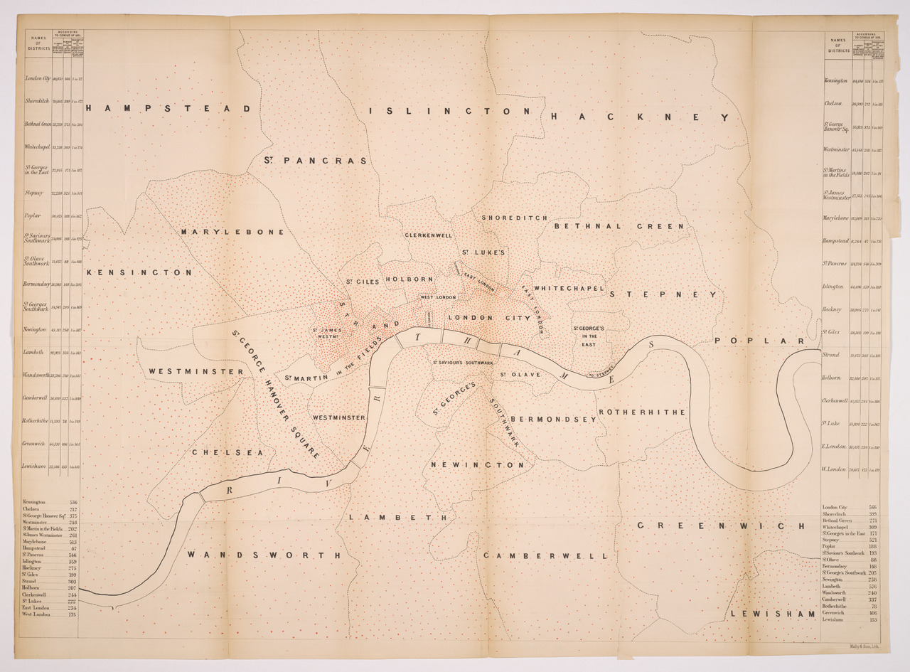
Map Shewing the Number of Public Houses in the Metropolis
Date Created & Temporal Coverage:
1859
Language: · English
––:»Map Shewing the Number of Public Houses in the Metropolis«
Map of Public Houses in London
In Collection
- Title
- Map Shewing the Number of Public Houses in the Metropolis
- Author/Creator
- John Taylor
- Date Created
- 1859
- Temporal Coverage (Time Period)
- 1855 – 1860
- Abstract
- Map of Public Houses in London
- Description
- The “Map Shewing the Number of Public Houses in the Metropolis” was published roughly at the same time that John Snow published his now famous Cholera map that argued for the theory of water borne transmission of the disease and against the dominant paradigm of miasma (Snow 1855). Both maps make visual arguments about London and threats to its health.
- Subject
- Alcohol
- Spatial Coverage (Place)
- London, United Kingdom
- Format/size
- 250x200cm
- Source
- Cornell University - PJ Mode Collection of Persuasive Cartography
- Language
- English
- Rights
- puplic domain
Narcotic Archive Item-ID
Permalink
https://narcotic-archive.org/s/archive/item/162

